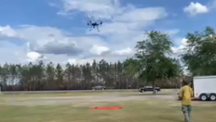
VIDEO: As ground crews continue their grueling battle against the Brantley County wildfire, a specialized team of U.S. Forestry firefighters is taking to the skies to hunt an invisible enemy.
Armed with a high-tech drone equipped with infrared sensors, the four-person aerial team is pinpointing hotspots that are invisible to the naked eye but pose a significant threat to local residences.
“Even when we’re not seeing flare-ups, we know that the heat is going deep into these organic soils,” said Karen Miranda, Public Information Officer for the Southern Area Complex Incident Management Team.
According to officials, the fire often retreats below the surface, smoldering in the nutrient-rich ground long after the visible flames have been suppressed. The infrared detector serves as a thermal eye, slicing through the smoke and soil to identify these subterranean threats.
The impact of the technology was felt immediately last week. On Thursday alone, the drone detected over 40 distinct hotspots.